Every Drop Counts.
Nexalix lets you log, locate, and analyse incidents across water networks with GPS precision and real-time visibility.
What changes when your network stops being invisible
Accounted For
GPS-precise reporting and faster dispatch let you document incidents sooner and resolve them before they drain your revenue.
Faster
Every incident arrives with coordinates, photos, and diagnostics. Crews show up prepared and supervisors have full visibility into the status of every intervention.
In Minutes
Regulatory submissions, board reports, and performance dashboards generated from real-time data, not weeks later.
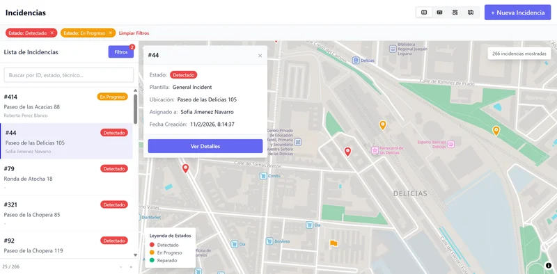
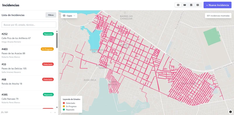
Your Network's Incidents, Visible
Don't just see your network. Understand what's happening in it.
Your Network's Incidents, Visible
Network layers integrate pipelines, valves, tanks, and pump stations into a single operational view to understand every incident in context.
- Identify high-loss zones and stretches with recurring incidents
- Plan interventions while minimising crew travel
- Analyse incidents by material, age, and network condition
Built for Trenches, Not Cubicles
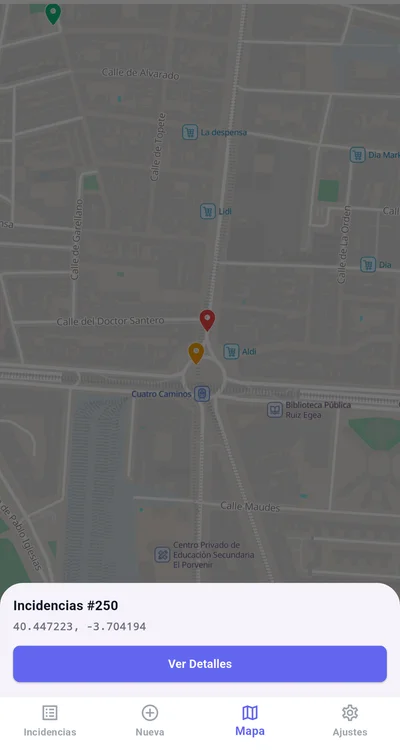
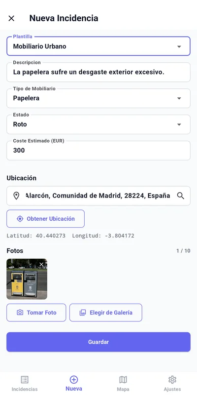
The mobile app works even without connectivity, logs GPS-tagged evidence, and guides field crews through inspections and repairs.
- Works offline with automatic sync on reconnection
- Captures photos and videos with automatic GPS location
- Digital signatures that eliminate paper forms
Indicators Under Control
Nexalix consolidates operational data into dashboards that let you track service indicators, water quality, and non-revenue water in real time.
- Indicator dashboards for operations and management
- Lab results linked to network sampling points
- Automatic alerts when service levels (SLA) are breached
Modular Platform
Activate only the modules your operation needs. Every deployment adapts to your network, with no unnecessary complexity.
Network Layers
EssentialImport pipe networks, hydraulic sectors, or pressure zones as network layers to visualise incidents in context.
Auto-Assign
Assign areas to teams, set schedules, and define rules per incident type. Incidents are automatically routed to the right team.
SLA Rules
Define response targets per incident type and severity, with automatic timers and breach alerts.
Assets
EssentialTrack pipes, valves, pumps, tanks, and treatment plants. Link every incident to the affected asset to maintain its operational history.
Citizen Reports
Public portal where citizens report supply issues, blockages, or quality incidents with GPS and photos.
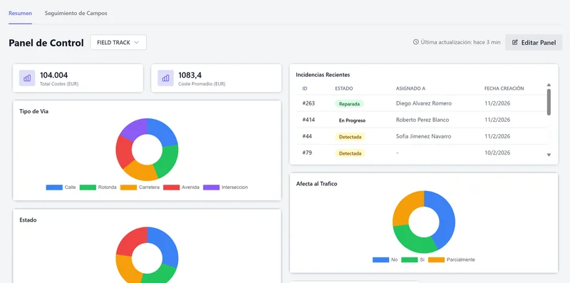
Cost Reports
Track repair costs, materials, and contractors per incident, zone, or asset.
Frequently Asked Questions
What is Nexalix for Water Infrastructure?
Nexalix for Water Infrastructure is a field operations management platform pre-configured for water supply and wastewater operations. It provides GPS-precise incident tracking, KML network mapping, crew dispatch, regulatory compliance reporting, and custom operational analytics for water utilities and concessionaires.
What types of water incidents can Nexalix track?
Nexalix tracks all water network incidents: pipe bursts and main breaks, valve failures, sewer blockages, water quality alerts, pressure zone issues, treatment plant incidents, non-revenue water events, and any custom incident type your utility defines.
How does Nexalix help with water regulatory compliance?
Nexalix generates regulatory reports directly from live operational data — no manual data gathering required. Every incident has a GPS-timestamped audit trail with photos and field diagnostics. Compliance reports, water quality records, and SLA adherence data are available instantly for regulators.
Does Nexalix support KML network mapping for water infrastructure?
Yes. Import pipeline, valve, reservoir, and pump station data as KML overlay layers. Every incident is visualised in the context of your physical network — identifying high-loss zones, recurring failure points, and infrastructure patterns.
Can water utility field crews use Nexalix offline?
Yes. The mobile app works without network coverage — technicians capture GPS coordinates, photos, diagnostics, and custom fields in the field. Everything syncs automatically when connectivity returns. Designed for trenches and remote sites, not just the office.
Your Network Has Blind Spots.
Every hour without visibility costs water, money, and trust.